My Favorite Place: Rattlesnake Rock

When I was a little girl, my family often took day trips to Wellsboro, Pennsylvania. In truth, “day trip” is a misnomer- any time my Dad turned the family van left out of Avis, we started a pilgrimage. Dedicated worshipers we were, visiting the same places year after year. Pictures, picnics, and family memories dot the mountains around Rt. 44 and Rt. 414.

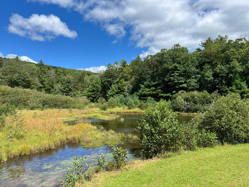
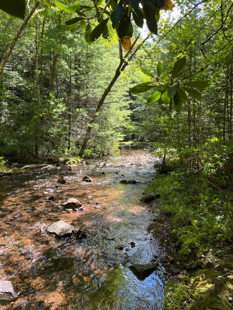
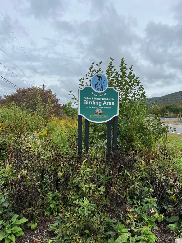
The forests in the High Allegheny Plateau are gorgeous, and almost wild. Now, there is little in the way of industrial improvement, and the remnants of an agrarian past lie fallow. A handful of homes tucked between the small towns, and the woods are full of hunting camps. Hiking trails, fishing holes, and canoe launches are everywhere. The Pine Creek area is an outdoorsman’s dream.

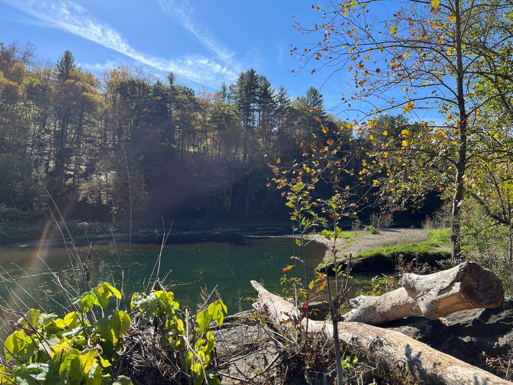
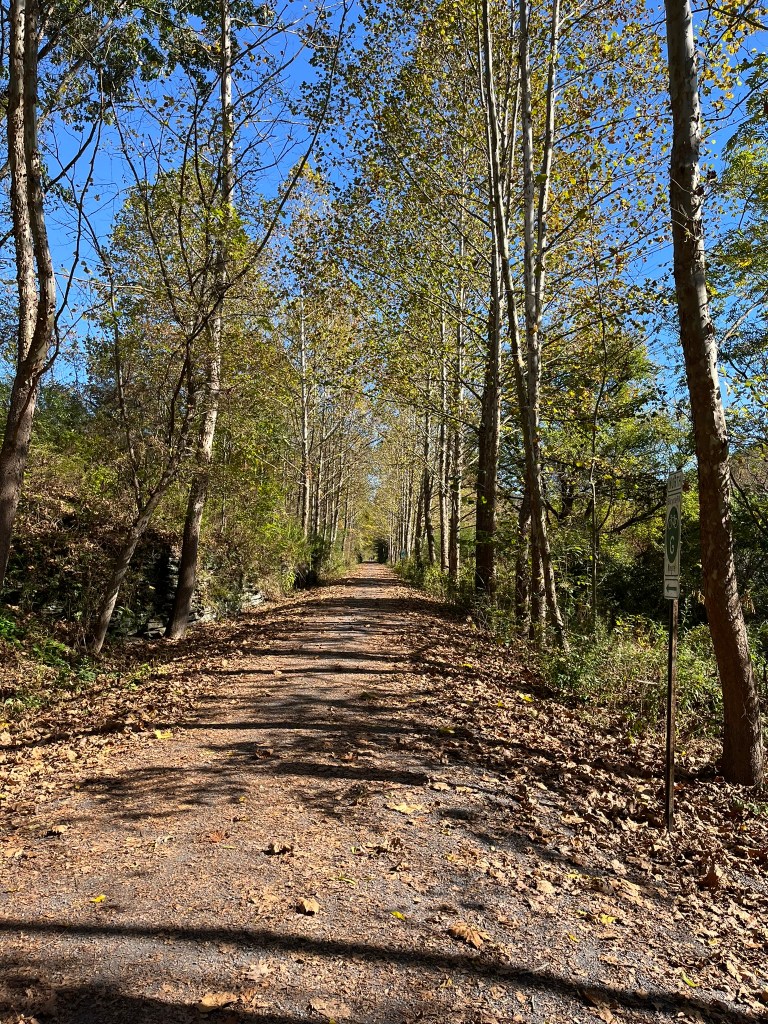
Between Cedar Run and Blackwell is my most favorite place in the world, Rattlesnake Rock. Tucked into a bend of Pine Creek, the rock juts out over the water, offering a beautiful 180 degree view. A short spur trail off the Pine Creek Rail Trail connects the Rattlesnake Rock Access Area and the rock.

As a child, my parents would pack us snacks to have while sitting on the rock, dangling our feet over the edge. In all my life, I have never seen a snake at Rattlesnake Rock, but I have seen evidence of other wildlife. Once, while visiting in the winter, we found an otter slide down the hillside and into the water. Another time, a shift in the rocks revealed an owl’s nest full of feathers and pellets.

In Philip Tome’s Thirty Years a Hunter, he shares a brief interlude at Rattlesnake Rock. He claims that the location was a stopover for traveling Native Americans. The high rock over the water would make a safe vantage point, being able to see upriver and downriver. He camped there overnight and moved on. The story led me to search for his fire ring- even though I was visiting in the early 2000s, almost 200 years after!

Beauty and history aside, Rattlesnake Rock is a geological curiosity. A recent study from Mansfield University claims that Rattlesnake Rock originates elsewhere. Research shows that Rattlesnake Rock is not in aligned with nearby bedrock. This suggests translocation of a block rather than deposition of sediments. The authors believe this happened during the formation of the Pennsylvania Grand Canyon… making Rattlesnake Rock a periglacial feature!

In college, I would drive to Rattlesnake Rock to retreat from the world. During periods of high stress or anxiety, I would leave a note for my friends and take off to unplug from the world. With the water swirling below me, and the sounds of bikers silenced by the thick trees, I could relax. Sometimes, I would take a book and bask in the sun while reading, and once, I took a nap. I have never felt alone at Rattlesnake Rock- instead, I felt immersed in the wild world and at peace.

For the twenty years I have been visiting, I have changed, and so has Rattlesnake Rock. More flora has crept in, and the rock worn smooth from many exploring feet. Parts of the rock have sloughed off into Pine Creek, and the water fluctuates every season. Yet, the heart of the place is the same- wild and wonderful.

Works Cited

Murphy, K. (2022). EVALUATING THE ATTITUDE OF RATTLESNAKE ROCK FROM THE PINE CREEK GORGE, LYCOMING COUNTY, PENNSYLVANIA. Confex.com; GSA. https://gsa.confex.com/gsa/2022NE/webprogram/Paper374904.html

Tome, P. (1928). Pioneer Life; Or, Thirty Years a Hunter. Being Scenes and Adventures in the Life of Philip Tome.

Picnicking at Penn-Roosevelt State Park

The turn off Old Rt. 322 onto Crowfield Road is innocuous. The road passes under the bridges and takes a sharp left, headed towards a small cleft in the valley. Cruising in my Jeep Patriot that day, the abrupt change from pavement to gravel woke my partner up from his nap. The 6-mile road up valley was a beautiful drive- one I had never seen before.

Up the mountain we climbed, passing many tidy hunting camps. The road reminded me of the way to my great-grandfather’s hunting camp. I mused on childhood memories while driving, and partner fell back asleep. Far too soon, we reached the rear entrance of Penn-Roosevelt State Park.

From behind, there are only signs to signal the entrance to the Park. The road splits off in two directions: a hard left turn over a bridge, or a gentler right turn downhill. First, we took the right-hand road, passing by the impoundment lake, picnic area, and CCC ruins. I turned around in a pull-off and headed back up to explore the other side- the tenting area.

We decided to picnic in the tenting area, as it was close to the vault toilets and a bearproof trash can. A few families were camping- the Park felt empty in comparison to Bald Eagle State Park. Yet, there was a subtle bustle and we had our meal and played card games in the quiet of the woods.

After a while, we hiked over to the impoundment lake, the largest remnant of the CCC camp which was here in the 1930s. S-62-PA, otherwise known as “Stone Creek Kettle” or “Penn-Roosevelt,” was 1 of 12 Black CCC camps in PA. Despite legislation calling for integrated facilities, CCC camps were segregated. Many, like Penn-Roosevelt, were purposefully placed in remote areas.

When the CCC workers arrived, there were no improvements. They had to build their lodgings themselves, camping in old Army tents. Throughout the CCC era, the men helped fight forest fires and aid in rescue during floods. Their work made a lasting impact on the area; some of the facilities they built are standing today.

The facilities here are simple, but beautiful. The impoundment lake has started to silt in, with the forest taking over. In the 1960s, the DCNR covered the original dam and created the small side spillway visible today. The restored hearth of the original recreation building is close by the day-use area. Other ruins were nearby, but we didn’t have the chance to explore them.

While ambling through the Park, I thought a lot about the geomorphology of the area. Stone Creek Kettle is not an actual kettle; a type of depression formed at the edge of glaciers. After some research, I couldn’t find any explanation for the name. DCNR recommended to contact Mr. Fagley, retired Greenwood Furnace State Park educator. He shared with me that in early America, folk considered any bowl-like feature a kettle. Mr. Fagley also mentioned in his e-mail that “neither the First nor Second Geological surveys of PA, both conducted in the 19th century, don’t mention the “Stone Creek Kettle” by this name, though do briefly mention the area and noted its geologic structure.”

After hiking around, we packed up for the day and headed back out Crowfield Road. Six miles later, we were on Old Rt. 322, headed for home. I wondered what the men of S-62 would have thought about the changes… what may have taken them hours or days to hike into the woods cost us an hour and a few dollars in gas.

Works Cited

DCNR. (2018, February 21). Recognizing the Conservation Work of Black CCC Companies in PA. Good Natured; Pennsylvania Department of Conservation and Natural Resources. https://www.dcnr.pa.gov/GoodNatured/pages/Article.aspx?post=33

DCNR. (2019). Penn-Roosevelt State Park. Pennsylvania Department of Conservation & Natural Resources. https://www.dcnr.pa.gov/StateParks/FindAPark/Penn-RooseveltStatePark/Pages/default.aspx

Fagley, P. (2024, September 11). Stone Creek Kettle Question [E-Mail to Autumn Dannay].

McNeil, A. (2022). Moving Forward Initiative: The African American Experience in the Civilian Conservation Corps. The Corps Network. https://corpsnetwork.org/moving-forward-initiative-the-african-american-experience-in-the-civilian-conservation-corps/#:~:text=To%20reduce%20community%20outcry%2C%20many

Pennsylvania CCC Online Archive. (n.d.). Camp Information for S-62-PA. Pennsylvania CCC Online Archive. Retrieved September 20, 2024, from https://www.iframeapps.dcnr.state.pa.us/stateparks/ccc/Camp.aspx?ID=88

The Curious Lives of Red Efts

Hurricane Helene was passing over as we searched for terrestrial amphibians. Despite the humidity, the air was chill, and the rain cold. My friend and I flipped log after log, searching for some sign of life other than fat earthworms and moss. When we least expected it, my friend found a tiny amphibian- a red eft.

With gloved hands, she gently moved the eft into a container with a moist paper towel, careful to not squish it. We admired its brilliant color- cheerful against the decaying leaves and muck. The newt was smaller than my thumb, its tail narrowing to a pencil tip in width. The newt curled up on the towel, as if to show off the red dots on its back.

Red efts are an interesting creature- part of the life cycle of red-spotted newts. These newts have four life stages: egg, larvae, eft, and adult. Adult female newts will lay eggs in submerged vegetation, which will hatch into eggs in 3-8 weeks. The incubation period depends on water quality. The better the water, the less time an egg needs to incubate.

After hatching, the newts will be larvae for 2-5 weeks. Yet again, the higher the water quality, the less time the larvae will need to metamorphose into an eft. An important factor now is food availability- the larvae will consume anything that can fit into their mouths. At this point in its life cycle, the newts have never touched land.

When the conditions are right, the larvae will metamorphose into an eft. Its external gills disappear and develop into lungs, and stubby legs erupt from the sides of its body. During the red eft stage, the newts do not need water to survive. Efts will haul themselves out of the water and into upland habitats. These habitats range from dry to wet, woodlands to meadows. When we were searching in the field, we were finding red efts under logs and flat rocks close to a stream.

Efts will remain as terrestrial sub-adults for 1 to 3 years. Yes, years! Efts will delay metamorphosis until conditions improve. Some newts have remained in the eft stage for 7 years. By remaining as efts, newts are able to survive drought in this manner. Until development into an adult, efts secrete a poison which makes them distasteful to predators. Their bright coloration serves as a warning: don’t eat me!

Once the eft has determined there is enough clean water and food, it will metamorphose to its final form. The adult newt is green and yellow with red spots, and lives in water. It has a long tail with a caudal fin, which helps it navigate in the water. After a complex mating ritual, the adult will lay eggs and begin a new generation of red-spotted newts.

I have yet to see a red-spotted newt in real life. I have seen many red efts- their bright bodies are easy to spot as they move from one habitat to another. I have seen red efts between the high outlook at Leonard Harrison State Park to the low streams of Bald Eagle. PARS has verified sightings of red-spotted newts in every county in Pennsylvania!

As the distribution of red-spotted newts is so wide, they are still at risk by changes in their habitat. Red-spotted newts absolutely need high-quality clean water to breed and grow. Protecting the health of Pennsylvania’s waterways will assist in protecting red-spotted newt populations. When looking for red efts, hunters must take utmost care to not crush the efts with their hands, logs, or rocks. It is best to look with eyes alone- try not to touch the efts at all! If it were not for our class, we would have left the newt my friend found completely alone.

After taking a few photographs, my friend released the eft back to its “home” log. It soon vanished into the leaves. Without a doubt, it would hide even deeper to escape detection from other curious people. I hoped it would live a long life, free of predation and making its final transition from land to water.

Works Cited

Connecticut Department of Energy & Environmental Protection. “Red-Spotted Newt.” Connecticut Department of Energy & Environmental Protection, Connecticut’s Official State Website, 11 Oct. 2016, https://www.portal.ct.gov/DEEP/Wildlife/Fact-Sheets/Red-Spotted-Newt. Accessed 30 Sept. 2024.

Poston, Jason, et al. “Red-Spotted Newt.” PA Herps, https://www.paherps.com/herps/salamanders/eastern_newt/. Accessed 30 Sept. 2024.

Early Fall at Soaring Eagle Wetland

The last full week of September had been misty, each morning starting with light rain and fog. That Thursday was no different, but as I was driving down Rt. 150, the fog started to rise. I continued my journey as the land to my left transitioned from parklands to towns, then to wetlands. I was heading to Soaring Eagle Wetland in Julian, a place long on my list to explore.

The parking lot was half-full with construction equipment, but I paid it no mind. I parked near the ADA parking and hopped out to survey the area. Goldenrod blanketed the lowlands around me, humming with life. A high chorus of insects almost drowned the birdsong, but I could catch the sound of sparrows and finches.

A paved pathway led to a boardwalk, dotted with grasshoppers. A big one caught my eye, and I managed to take a picture before it flung into the grasses. Birdsong grew louder closer to the small trees, dominated by the chips of swamp sparrows. I passed a cute bench and made it to the accessible fishing area.

Bald Eagle Creek rushed by the pier, and I took a break on the bench. Later, I explored down to the water using the accessible ramp, and continued to a worn trail to the water’s edge. I stepped out, and enjoyed the cool flow of water over my boots. Not wanting to disturb a fisherman, I headed back to the trail.

Other trails branched off from the paved section. One path looked new, level and graveled alongside Bald Eagle Creek. A grassy path, named “Long Trail” headed out into the goldenrod. If I had more time, I would have explored Long Trail. I was a little put off as the brochure map was not detailed, not listing a length or difficulty. I can imagine it is an easy trail, but as I was alone with poor cell reception, I was hesitant to depart from my plan.

Heading back to my car, I saw many nesting boxes of all shapes and sizes. Bluebird boxes were close to the paved trail, and larger owl boxes were high in the trees. One of the owl boxes had been in recent use, with sticks and grasses poking out in the seams.

Soaring Eagle Wetlands has a second area- the Galen & Nancy Dreibelbis Birding Area. I went there next, hoping to complete a checklist. I followed a small gravel trail to an accessible viewing pier. A small plaque shared that the platform was a 2022 Eagle Scout project. Immediately below me were many frogs, moving too fast for me to photograph.

While at the platform, I took a sound recording with Merlin. The app heard blue jays, American goldfinches, and grey catbirds. The app struggled to identify birds over the sounds of Rt. 150 and insects. With my binoculars, I spotted some wood ducks landing in the water. They were definitely too far away for Merlin to catch their oo-eek calls.

Before leaving, I checked out the blind by the accessible parking. Yet another beautiful view out of its window- one I would have loved to admire for much longer! Another path branched off from an accessible ramp.

On my drive home, the clouds descended again, and the rain began again. While I was leaving Soaring Eagle Wetland behind, I already knew I would return. Next time I know to plan for more bug spray and time to walk the trails.