Tag: explore

  • Indiana County’s Buttermilk Falls

    Indiana County’s Buttermilk Falls

    Usually the drive home from Pittsburgh area is uneventful- easy miles on Rt. 22 punctuated by Sheetz and upland forests. After 30 minutes on the road headed home, we decided to take a minor detour to Buttermilk Falls Natural Area.

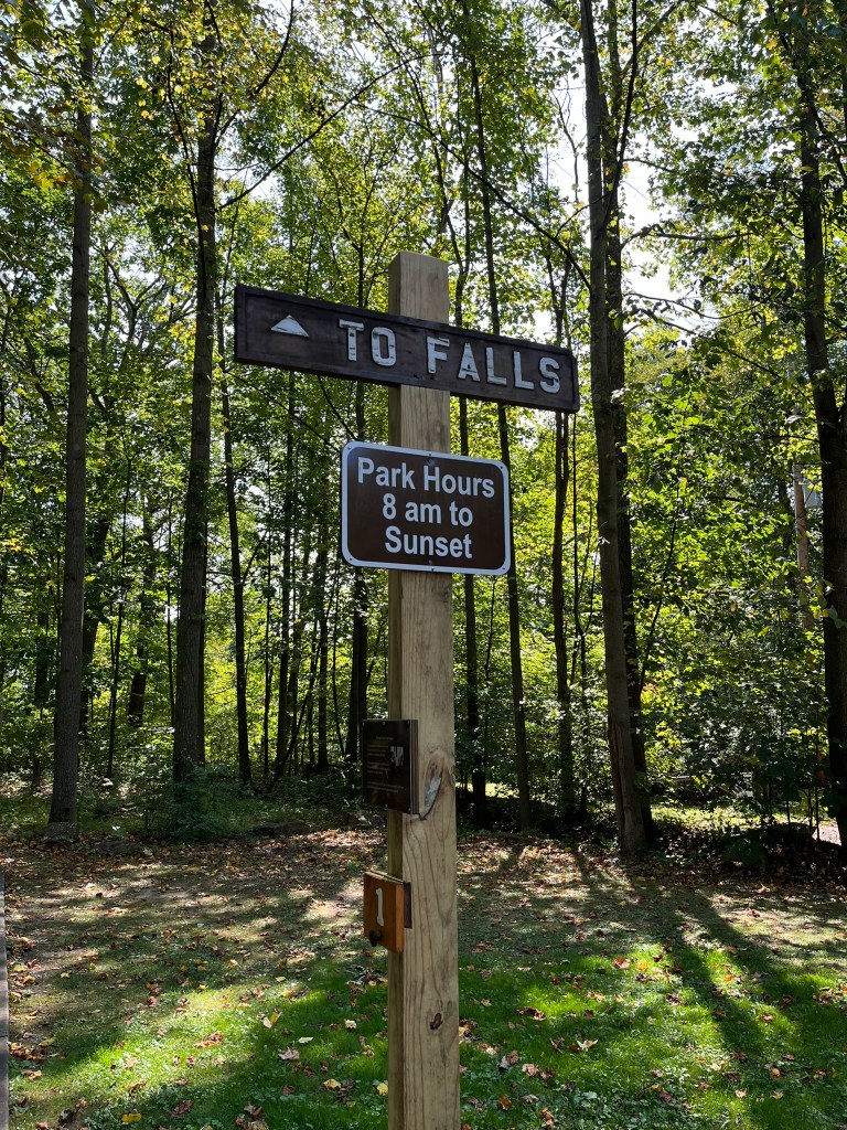
    A few miles down a country road, we pulled up to a gate staffed by a security guard. He provided simple directions: McFeely Trail to our right, and the Falls Trail to our left. After parking in the overflow section, we stretched our legs and headed to the trail on our left.

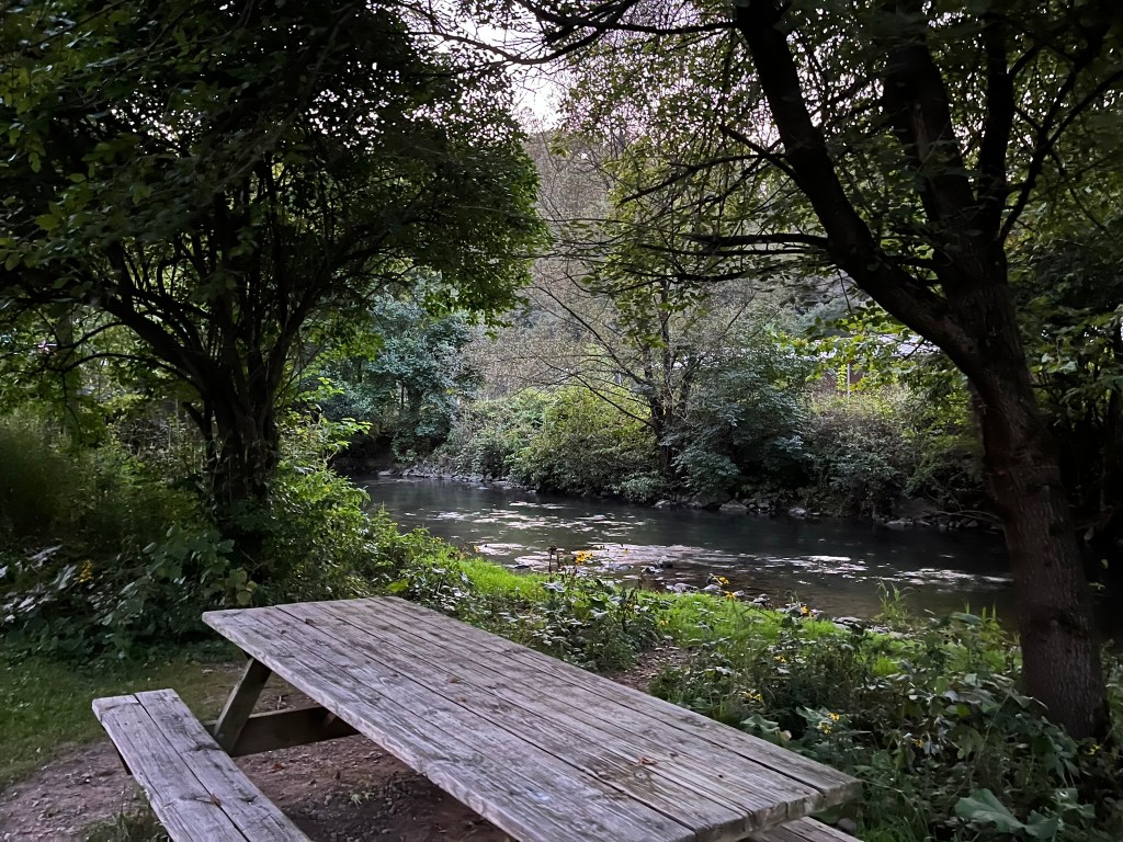
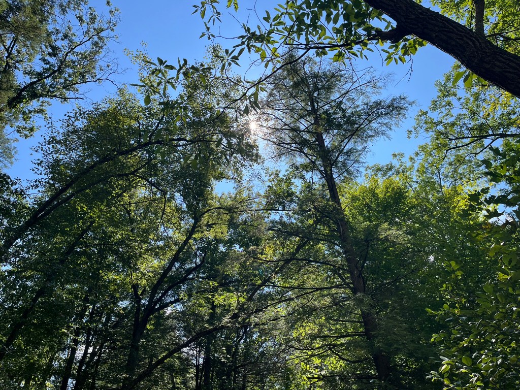
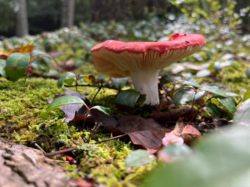
    Crisp 65° air filtered through the trees while we meandered down the trail. We admired the accessibility of the walkway as it gracefully turned down the valley. Plenty of signs warned visitors to not stray off the trail- delicate plants grew near the Falls. I noticed plenty of common jewelweed, a sign that deer avoid the area.

    We neared the first viewing platform in short order. Stepping out to the wooden deck, I couldn’t see any running water through the trees and brush. Straining my ears over the sounds of other hikers, I couldn’t hear a waterfall at all.

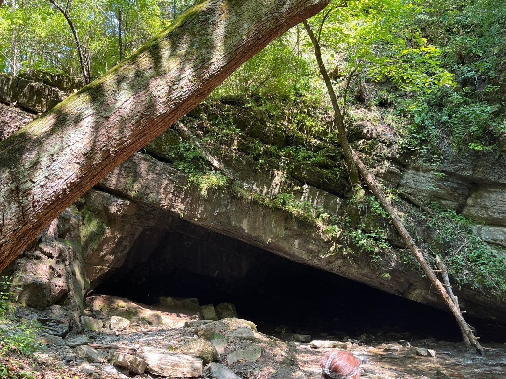
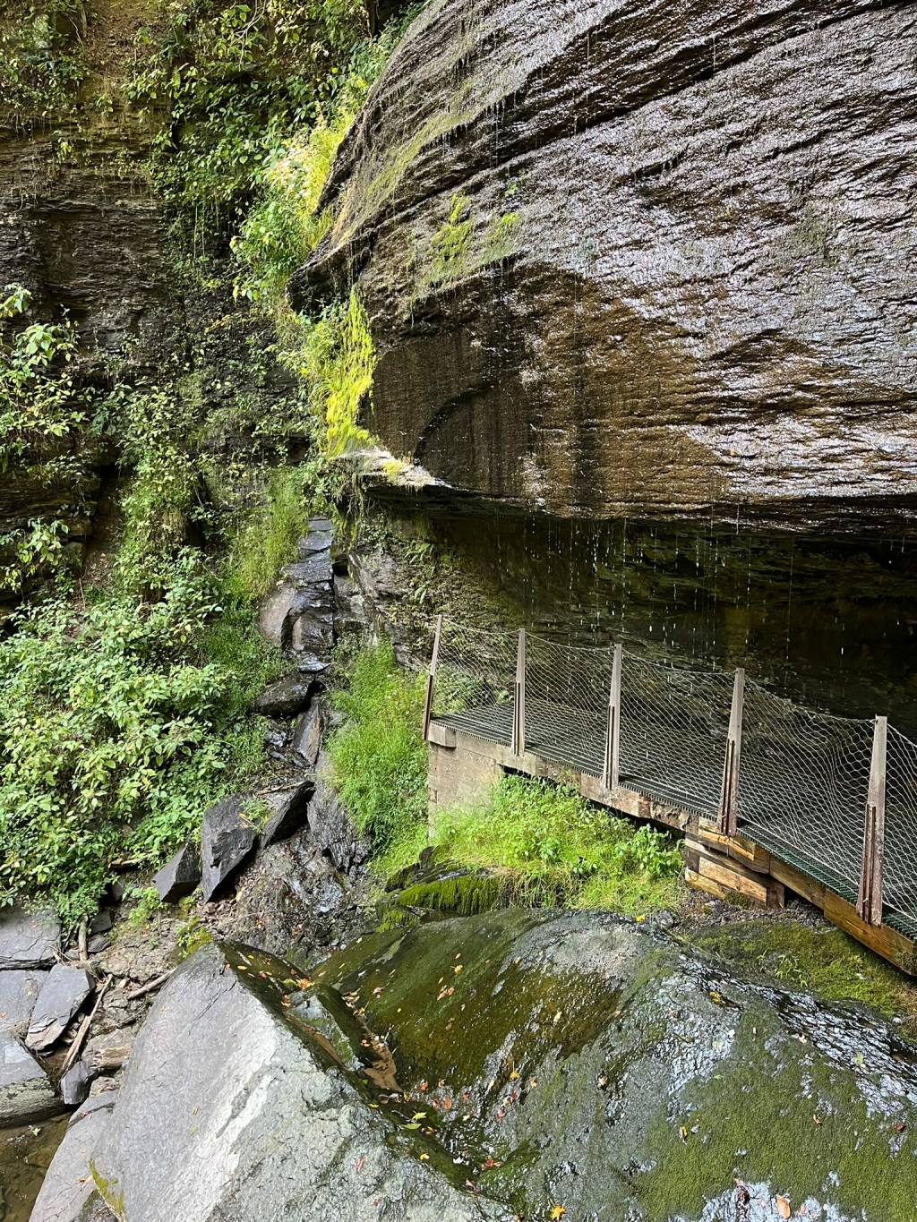
    Past the first viewing platform, the trail continued over the crest of the falls to a second viewing area. Stairs descended the far side of the valley and led to a platform under Buttermilk Falls. Once we were on the Eclipse Bridge, I realized that Hires Run was very low. Water still descended the valley, but it was a gentle trickle than the roar I was hoping for.

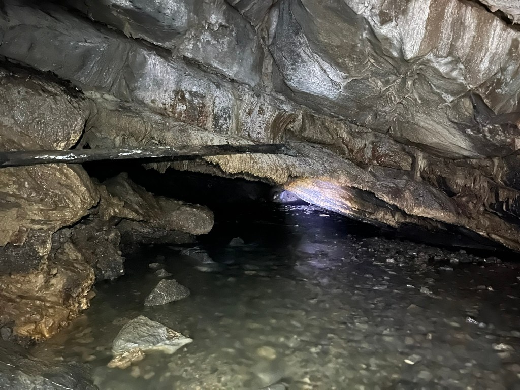
    Other hikers passed us as I led my partner down the stairs. Late summer wildflowers leaned over the cliffside; wood asters full of bumble bees. As we neared Buttermilk Falls, the scent of cool, wet rock permeated the air. As I waited for hikers to clear the area, I watched two small fish dart in the water pooling at the falls’ base.

    We were soon able to walk behind Buttermilk Falls. A thick block of sandstone between two layers of shale allowed for an overhang to develop. Unfortunately, graffiti covered some of the shale wall behind the Falls. I wondered why visitors would want to deface natural beauty with grotesque images. As if to spite the graffiti, moss was spreading over the rock.

    After snapping a few pictures, we started climbing back up the stairs to take a look at the rubble by the falls’ crest. From 1930 to 1956, Mr. Roger’s grandfather owned property along Hires Run, which Mr. Rogers visited as a boy. The foundation of the home, and the weirs used to dam Hires Run are still there. As children were exploring the area, I didn’t dare disturb the rocks to look for salamanders.

    Walking back up the trail, we took our time to talk about football and decide that we will have to stop again. I want to visit in spring, when Hires Run is high and wildflowers are in bloom. My partner would like to visit when the Fall colors riot through the valley in mid-October. At any time, Buttermilk Falls are beautiful, and worth preserving. I’m thankful Indiana County Parks cares for this area and encourages visitors to do the same.

    Works Cited

    Indiana County Parks & Trails. “Buttermilk Falls.” Indiana County Parks & Trails, 26 Feb. 2024, www.indianacountyparks.org/our-parks/buttermilk-falls/. Accessed 9 Sept. 2024.

  • Birding at Fisherman’s Paradise

    Birding at Fisherman’s Paradise

    I turned left off Rt. 150 and started down Paradise Road as the sun faded behind low clouds. Driving slower than I should, I admired a small limestone outcrop and continued on. Soon after, I turned on Spring Creek Road and headed upstream to Fisherman’s Paradise.

    At first, I missed the meeting spot for the State College Birding Club. I turned around at the gate to Fisherman’s Paradise and headed back to a lot near the gate to the Bellefonte State Fish Hatchery. A few cars were there, and I lingered by my Jeep so I could introduce myself to the person unloading their chair.

    Introductions over, we walked along the bridge to the gate and set up our chairs. Already herons were perching on evergreens across the facility, with more flying in. An awkward, shrill call of a Bald Eagle echoed the narrow valley. At first glance, I counted 11 Great Blue Herons, scattered through the canopy.

    Across my vision came the calling Bald Eagle- a juvenile on the cusp of adulthood. While its head and tail were white, a smattering of white feathers down its back shown its age. As it wrangled with a fish on a snag, a younger Bald Eagle soared in, perching on a branch nearby.

    Juvenile bald eagle” by USFWS/Southeast is licensed under CC BY 2.0.

    One of our members arranged a scope at the pair, and as we watched them, another eagle rang out. Agitated, the herons started rearranging themselves, calling amongst themselves. As I was watching a heron pick on a neighbor, an adult Bald Eagle landed in the upper story of an evergreen. I watched as it threw its head back and called, cackling over the herons.

    At this point, the herons started blending with the trees as the sun set in earnest. The eagles were easier to watch, with their white heads flashing against the shadows. A fourth Bald Eagle dropped out of the sky to land in another tree, causing a ruckus among herons. Their guttural croaks floated across the valley, much like an old man’s groan of dismay.

    Since the sun was dipping closer to the tree line, small bugs rose out of the water and fluttered around our group. On cue, cedar waxwings emerged from the trees behind us and started catching the bugs. Mesmerized, I watched the songbirds catch insects on the wing for some time. Not long after the cedar waxwings, tree swallows shot out from behind buildings. Together, the birds drove the insects down, leaving us alone.

    Common Nighthawk” by Fyn Kynd is licensed under CC BY 2.0.

    As I was packing up to leave, our group had one more surprise: a pair of migrating Common Nighthawks. To the right side of the valley, the hawks seemed to hover over the treeline. This was my first sighting of Common Nighthawks, and I rushed to note them in eBird before heading off to my car.

    For an area renowned for its fishing, the birding was excellent. For 60 minutes, I observed a total of 7 species and 26 birds. Our group observed 14 species and 52 birds. The area is available from sunrise to sunset throughout the year. While a visitor cannot cross into fenced areas, there is space near the gate to set up a chair and observe.

  • Caving Tytoona Cave Nature Preserve

    Caving Tytoona Cave Nature Preserve

    In August, I revisited a favorite place: Tytoona Cave Nature Preserve. This was my 3rd time visiting. Tytoona continues to ignite excitement and curiosity in my heart!

    Before You Continue

    Caving is a dangerous activity. Dying while caving is 100% possible, no matter how “safe” you believe you are. To explore Tytoona, you need a permit from the National Speleological Society (NSS). You will agree to the Preserve’s Access Rules. More details are on the NSS website at: https://caves.org/preserve/tytoona-cave-nature-preserve/.

    Karst Geology

    Caves form underground when water dissolves soluble rock. A “soluble rock” is a rock that dissolves in water: limestone, dolomite, marble, and salt. Limestone and dolomite are sedimentary rocks which form via lithification of carbonate sediment. Marble is metamorphic, forming from limestone or dolomite after metamorphic stress.

    Water dissolves rocks and forms specific phenomena labeled as karst. Sinkholes, disappearing streams, springs, and caves are examples of karst. Sinking Valley in Centre County is a good example of karst topography. The landscape is full of rolling hills and streams that seem to “disappear” or “sink” into the ground. Scattered throughout the valley are sinkholes and a handful of caves.

    One stream, Sinking Run, formed a cave system- Tytoona. From its headwaters near Fort Roberdeau, Sinking Run “disappeared” into the ground. Water percolated through bedrock, dissolving limestone to form caverns. In one location, the water weakened the rock to cause the roof of a cavern to collapse, creating an entrance.

    Inside Tytoona

    Throughout Tytoona, speleothems are small. Formations like stalagmites, stalactites, draperies, and straws are often swept off by floodwaters. Some flowstones are visible along higher shelves in the cave. During my last visit, I struggled to take pictures of the formations close by.

    Visitors must be mindful of the water- it is easy to slip and fall. Some areas of water are very deep. The area I was exploring had dry walkways, with Sinking Run ankle-deep to my right. When Sinking Run is high or fast, it’s too dangerous to enter the cave.

    True History

    Speleologists theorize that Tytoona connects to Arch Springs through a series of sumps. These underwater passages are difficult to explore and map. When I was younger, I had the opportunity to explore all the way to the back of the permit area. My instructor sat the class on gravel and told us the story of Roberta Swicegood, who lost her life in Tytoona.

    In the late 1980s, Roberta was an experienced and passionate cave diver. She and John Schwein were surveying Tytoona. As a team, they were solo diving a series of sumps in zero-visibility waters. During their dives, the team was installing guide lines to help navigate in the darkness. On her last dive, Roberta left John behind and forged ahead into the unknown.

    While surveying the sump, Roberta separated from the guide line. Speculation believes she ran out of air while searching for the line. Eventually, she fell asleep and then suffocated, alone in the darkness. After four days of recovery work, rescuers returned her body to the surface. She was found about 10 feet away from the guide line. If she had been able to reach the line, she could have survived and returned on her own.

    After Roberta’s death, the property owners forbade diving and enacted a permit program. NSS is serious about enforcement, visitors are not to enter without a permit. Since Roberta’s passing, there have been no deaths in Tytoona.

    Concluding Thoughts

    Despite the danger, exploring a wild cave is a marvelous experience. With enough time, water creates beautiful and complicated features underneath our feet. While I have visited many times already, I know there are always more Tytoona trips for me in the future!

    Works Cited

    Czmor, Garrett. Tytoona Cave Preserve. Mid-Appalachian Region of the National Speleological Society, Dec. 2000, www.mar.caves.org/tytoona.htm. Accessed 6 Sept. 2024.

    “Inside Cave, a Deadly Mystery.” Altoona Mirror, Altoona Mirror, 26 June 1988, www.newspapers.com/article/altoona-mirror-schweyen-cave-diving-dea/4043745/. Accessed 6 Sept. 2024.

    Kevin Patrick. Pennsylvania Caves & Other Rocky Roadside Wonders. 1st ed., Stackpole Books, 2004, pp. 57–59.

    “Tytoona Cave Nature Preserve.” National Speleological Society, 30 May 2024, www.caves.org/preserve/tytoona-cave-nature-preserve/. Accessed 6 Sept. 2024.

  • Helping a Wood Turtle

    Helping a Wood Turtle

    During my drive to the grocery store, I saw an odd grey lump on the road ahead of me. At first, I didn’t think anything of it. I figured that the rainstorm had washed deadfall onto the road. As I was driving closer, I little knob popped out of the side- it was a turtle!

    I pulled off and parked, throwing on my 4-ways as the rain started back up again. A driver slowed down and swerved around the turtle, missing it. I dashed up, snapped a quick picture, and took it to the side of the road.

    The turtle looked a little different from the ones I usually see. This turtle didn’t resemble from the Eastern Painted Turtle, my favorite. It had large, dark eyes and deeply textured scutes on the carapace. The yellow-orange on its underside was bold in comparison to the humble grey topside. With a little research, I learned it is a species of special concern- the wood turtle!

    Wood turtles, Glyptemys insculpta, are a semi-aquatic species of turtle whose range covers the majority of Pennsylvania. Wood turtles are globally endangered according to the International Union for Conservation of Nature (IUCN). In Pennsylvania, wood turtles are under “special concern.”

    Wood turtles prefer grassland, forest, and river habitats. I found this turtle near Fishing Creek, an area where many habitat types intersect. The area borders the Clinton County Country Club golf course and a wooded section of Mill Hall. With the stream, forest, and grass all butting up against each other, it is an ideal location for a wood turtle to live.

    Once I was home and reading more about the wood turtle, I felt frustrated. Aside from helping one turtle off the road, how can I help more of them?

    Enter the the Pennsylvania Wildlife Action Plan (PWAP) by the Pennsylvania Fish and Boat Commission (PFBC). This project was designed to identify and categorize vulnerable/endangered species. Additionally, the project helps Pennsylvanians implement measures to support these species.

    PWAP lists the wood turtle as having a stable population over the next 10 years, but is vulnerable in the long run. The state’s priority is to improve knowledge of distribution and population parameters.

    PWAP lists several specific threats to wood turtles: poaching, habitat loss, and road collisions. In pet circles, wood turtles are “very tame and friendly.” It was easy to find a site instructing the reader how to care for their wood turtle. With a little more digging, I found websites selling wood turtles! In hindsight, I was glad I found the turtle and moved it off the road before it was killed or poached.

    We can support wood turtles by reporting sightings to the Pennsylvania Amphibian and Reptile Survey (PARS). PARS tracks population data and shares data with the PFBC. Reporting sightings will help with the state’s primary goal of increasing population knowledge. As with other endangered species, we can also continue to support the conservation of its preferred habitat. In my area, I plan on spending more time picking up trash around the lake.

    After everything I’ve learned, I’m glad I was able to help this turtle cross the road. I’m honored to have interacted with a rare species! While current projections are bleak, with effort, we can change the future. Focusing on habitat preservation near our homes helps support long-term population stability. I hope that the wood turtle will remain in Pennsylvania for many more generations!

    Works Cited

    Hamilton, Bob, et al. “Wood Turtle.” PA Herps, 2023, www.paherps.com/herps/turtles/wood_turtle/. Accessed 2 Sept. 2024.

    Myers, Joe. “Wood Turtle Care Sheet.” Reptiles Magazine, 3 Nov. 2014, www.reptilesmagazine.com/wood-turtle-care-sheet/. Accessed 2 Sept. 2024.

    “Species of Greatest Conservation Need Species Accounts Appendix 1.4D-Reptiles.” Pennsylvania Fish and Boat Commission, 4 Nov. 2019.

    U.S. Fish & Wildlife Service. “Wood Turtle (Glyptemys Insculpta).” U.S. Fish & Wildlife Service, www.fws.gov/species/wood-turtle-glyptemys-insculpta. Accessed 2 Sept. 2024.

    van Dijk, P.P., and J. Harding. “Wood Turtle.” IUCN Red List of Threatened Species, Name, 2011, www.iucnredlist.org/species/4965/97416259. Accessed 2 Sept. 2024.

  • Visiting Karl B. Guss Picnic Area

    Visiting Karl B. Guss Picnic Area

    This past week, my partner and I took a trip to Tuscarora State Forest to picnic at the Karl B. Guss Picnic Area. I was not disappointed in this new-to-me place.

    About Tuscarora State Forest

    Tuscarora State Forest covers over 96 thousand acres in 5 counties. These counties are Cumberland, Franklin, Huntingdon, Juniata, Mifflin, and Perry. Named after Tuscarora Mountain, this State Forest honors the Tuscarora People. Through the 17th and 18th centuries, the Tuscarora People were exploited by colonists. Many Tuscarora were sold to Pennsylvania as slaves. In 1705, Pennsylvania banned the importation of indigenous slaves. Extirpated from their homelands, the Tuscarora People briefly settled along the Juniata River. Later, the Tuscarora completed their emigration to New York and were accepted as part of the Iroquois Confederacy. Now, the Tuscarora Nation of North Carolina is headquartered in Maxton, North Carolina.

    The State Forest was originally established as “Rothrock Forest Reserve” in 1902. The entire area was lumbered out during Pennsylvania’s logging era. In the 1930s, the Civilian Conservation Corps (CCC) founded several camps in the area. I could find record of 5 camps: S-55 Big Spring, S-56 East Licking Creek, S-58 Bell Furnace, and S-110 Kansas Valley. DCNR reports 6 camps, but records and place-names are not consistent, with several companies sharing one camp.

    Tuscarora State Forest has a variety of attractions. There are 3 listed picnic areas: Karl B. Guss, Bell Furnace, and Big Spring. There are 2 State Parks: Bell Furnace and Col. Denning. Tack on 2 Natural Areas: Frank E. Masland, Jr. and Hoverter & Sholl Box Huckleberry. Truly, Tuscarora State Forest holds something for everyone. We explored the Karl B. Guss Picnic Area in Juniata County.

    Exploring the Picnic Area

    Karl B. Guss Picnic Area is along East Licking Creek. East Licking Creek is an unlisted trout stream- few wild trout, but a substantial population of stocked fish. From one fishing platform over a deep pool, I spotted at least 10 tiny fish. To my touch, the water felt cool enough for trout to habituate and potentially breed. Penn State’s Riparia site lists East Licking Creek’s disturbance class as “pristine.” This is obvious in my photographs- aside from the fishing platforms, there is no obvious evidence of human intervention.

    I noticed that the mossy ground had a huge number of mushrooms. I recognized brittlegills and jack-o’-lantern mushrooms right away. I also saw mushrooms composed of many small yellow spires congregated near a field mouse shelter. Some of the mushrooms were covered in a white substance- mycelium! I hadn’t seen such a huge variety of fungi in one spot- there were many I wasn’t able to capture in a photograph.

    Tuliptrees dominated the forest around the Picnic Area. Early tulip leaf fall covered some trails in a yellow-orange carpet. My hammock was between two oak trees, and I spent a lot of time admiring their canopy above me. Red Oak and White Oak were scattered throughout the picnic area, supplemented with evergreen and hemlock trees. I didn’t spot any cicadas, but their screams were heard in the trees all around us.

    The Bureau of Forestry (BoF) keeps the area up well, but some trails were overgrown. After having Lyme’s Disease as a teen, I am hesitant to hike in unkempt areas. I had brought along some Deep Woods Off, but even then, it wasn’t enough to keep the blackflies away. The picnic facilities were in good condition, with no obvious disturbance from bears. There are no bear-proof trash containers, so if there are bears, they enjoy whatever is left from picnickers.  

    Thinking of the Future

    I had a blast exploring the Picnic Area. The lack of cell service was great- I felt like I could focus on nature. I took two whole pages of notes! There were many trees perfect for hanging a hammock. I laid in mine for well over an hour, simply to admire the canopy of the oak trees over me. In the future, I would like to put on waders and take a walk up Spectacular Run to look for amphibians and reptiles.

    The Karl B. Guss Picnic Area was an excellent place to start exploring Tuscarora State Forest. I can imagine families returning year after year- which is what my partner’s family does. They have utilized this Picnic Area in the 60s when it opened! Proof perfect that our DCNR system is a lasting Pennsylvania tradition.

    Works Cited

    85. East Licking Creek. (1999). Riparia; The Pennsylvania State University. https://riparia.psu.edu/85-east-licking-creek/

    Pennsylvania Civilian Conservation Corps Online Archive. (n.d.-a). Camp Information for S-55-PA. Pennsylvania CCC Online Archive. Retrieved September 1, 2024, from https://www.iframeapps.dcnr.state.pa.us/stateparks/ccc/camp.aspx?ID=81

    Pennsylvania Civilian Conservation Corps Online Archive. (n.d.-b). Camp Information for S-56-PA. Pennsylvania CCC Online Archive. Retrieved September 1, 2024, from https://www.iframeapps.dcnr.state.pa.us/stateparks/ccc/camp.aspx?ID=82

    Pennsylvania Civilian Conservation Corps Online Archive. (n.d.-c). Camp Information for S-58-PA. Pennsylvania CCC Online Archive. Retrieved September 1, 2024, from https://www.iframeapps.dcnr.state.pa.us/stateparks/ccc/camp.aspx?ID=84

    Pennsylvania Civilian Conservation Corps Online Archive. (n.d.-d). Camp Information for S-110-PA. Pennsylvania CCC Online Archive. Retrieved September 1, 2024, from https://www.iframeapps.dcnr.state.pa.us/stateparks/ccc/camp.aspx?ID=37

    Pennsylvania Department of Conservation & Natural Resources. (2020). Tuscarora State Forest Map and Recreation Guide [Map]. Pennsylvania Department of Conservation and Natural Resources.

    Picknicking in Tuscarora State Forest. (2019). Pennsylvania Department of Conservation & Natural Resources. https://www.dcnr.pa.gov/StateForests/FindAForest/Tuscarora/Pages/Picknicking.aspx

    Tuscarora Nation of North Carolina. (2024). Our History . Tuscaroranationnc.com. https://tuscaroranationnc.com/our-history